Mt. Athos u-topias: A cartographic afterward in Thomas More Utopia island
10 December 2012This intervention is a short comment about maps, mythical islands, the internal quest for the ideal City and the way that all this concepts are related to Athonic monastic community.

For the past ten years, Mount Athos Map Library and Hellenic National Map Library established their common attempt to organize and implement a cartographic heritage-referenced project exploiting the historically important backlog of Mount Athos peninsula’s maps. Among other actions, there is the publication of the volume Όρους Άθω Περίμετρον – Χαρτών Μεταμορφώσεις [Holy Mount Athos Metamorphosis in Maps], National Map Library, Thessaloniki 2002 and several exhibitions in Thessaloniki (2002), Beograd (2003), Helsinki (2006) and elsewhere.
The Island, a small piece of land isolated from the surrounding Sea and the immense Ocean, is an unusual, mythical, imaginary, mysterious, unreachable, quite often “forbidden” and always attractive topic in the History of Geography and Cartography since the beginnings of these Sciences in antiquity.
The islands consist significant points of reference for Cartography: e.g. the mythical island of Thule was the border of the Known World to the upper North, while Islas Fortunatas (today Canary Islands, Spain) served as the beginning for counting the geographic longitude until the 17th. c. Moreover, when, for the first time in history, the human mind conceived the system of coordinates as a way to describe the World, it was an island that served as its center that is as the point zero: the island of Rhodes, homeland of the philosopher Dicaearchus (3rd c. BC), the very same island where this Forum is taking place today.
The ideal of the mythical Island has been an attractive topic for Philosophy, Poetry, Literature and Art as well. We could recall the mythical islands in Homeric Odyssey, the platonic Atlantis, and the early Christian Paradise in some island to the upper East (slide 4). Throughout the years, the search for the Ideal City inspired several authors and poets, who insisted to refer to far distance, unexplored islands (slide 5). Yet, the geographic, ideological, moral, but also scientific adventure of “island loci” finds its foremost manifestation in Utopia, work of the English lawyer, social philosopher, author, statesman and noted Renaissance humanist Sir Thomas More (1478-1535). In 1516, More published the book De optimo reipublicae statu, deque nova insula Utopia, widely known as Utopia. The book, written in Latin, was a novel depicting a fictional island society and its religious, social and political customs. More coined the word “utopia”, from the Greek words ou (οὐ), “not” (or eu (ευ), “good”) and topos (τόπος), both “no-place-land” as well as “good-place-land”, a land without geographical reference in any case. The utopian land was soon associated with the concept of the “ideal island”, a voyage to the country of Nowhere, until such time as the faith in progress makes it the promise of a reality to come.
In Utopia, More described an island where all citizens live in harmony, without paying any attention to material goods, since these are common for all, with a perfect distribution of labor, without any antagonism, in a relation of brotherly friendship, without any kind of political or religious oppression. There is a lot of research done in relevant bibliography about the model of political thought that inspired More for his utopian city. A very interesting study by P. Huber (Huber, 1995), associates the latter’s descriptions with Mt. Athos:
Utopia
1. Private property is abolished
2. There are 54 towns in the island, with ~6000 households each. The Utopians are believed to be of Greek origin
3. Main toponyms: Amaurotum urbs / Fons Anydri (Dry Spring) / Ostium Anydri (Dry River Mouth)
4. King Utopos, the settler, created a canal in order to convert the peninsula into an island
Athos
1. Monastic common ownership is in force
2. The imperial Typikon of 972 BC is signed by the representatives of 54 monasteries, sketes and “kellia”, with ~6000 monks
3. Toponyms: Xeropotamou (Dry River) Monastery / Xeroryakiou (Dry Stream)Monastery / Xerokastrou (Dry Castle) Monastery
4. King Xerxes tried to create a canal in order to convert the peninsula into an island (481-480 BC)
Cartographers tried to depict this mythical island, thanks to More’s detailed descriptions: In the very first editions of Thomas More Utopia, (Louvain 1516, Basel 1518), Utopia island acquired its maps on woodcuts by an unknown artist and by Hans or Ambrosius Holbein respectively. Concerning the origin of this Utopia’s “maps”, we should notice that there is no reference to some cartographic model which may have been used by the engravers for the representation. Nevertheless, we cannot avoid the temptation for some comments:
The circular form of the island may have its origin in the great tradition of medieval Orbis Terrarum (OT) maps, where the circular world, actually an island as well, is surrounded by the unexplored Ocean. Far before them, the ancient Greek philosophers Anaximandrus and Hecataeus (6th c. BC) described a circular World (Moreover, the entrance to the “port” (Mediterranean Sea) is the Pillars of Hercules (today Gibraltar), quite often represented monumentally in OT maps.
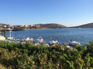
Isolaria, a sort of island atlases, with special interest for Aegean sea’s islands, were popular between 15th-17th c. The Mt. Athos map in Henricus Martellus’ isolario, was published only a few decades earlier (1480-90) than More’s book. Although it is usual to conclude Mt. Athos’ map in isolaria (slide 10), this map is a rare sample of early Mt. Athos’ depictions, where the athonic peninsula is presented almost circular, with a major and impressively clear gulf at its south edge, and the majority of buildings (17 at all), compared to other isolaria.
The 17 foundations depicted, thematically differentiated, are divided into three categories: The three major foundations, with their toponyms, are placed in a triangular arrangement; Lavra SE, Vatopedi N, St. Basil (today Chilandari) S. There are also 8 constructions in the intermediate category and 6 smaller buildings in the third category. Correspondingly, in the two Utopia’s maps, three major cities are depicted in the centre of the island, also in triangular arrangement. Eight more towns are depicted in the perimeter, a total of 11, which coincides with the number of the holy buildings in Martellus’s Mt. Athos map.
Finally, a detail in Basel’s edition (1518), a tower in ruins on the steep coastal right edge and its similarity to the Amalfitans’ tower, in the area of Morfonos in Mt. Athos, seems to justify the temptation and the risk of a cartographic reference to Thomas More Utopia.
*First published in: Pazarli M., The u-topias of Geography and Maps / E. Livieratos, An afterword on Utopia island, in: E. Livieratos (ed.), Όρους Άθω Περίμετρον – Χαρτών Μεταμορφώσεις [Holy Mount Athos Metamorphosis in Maps] (In Greek): National Map Library, Thessaloniki, 2002, where all the relevant bibliography.
Maria Pazarli is an archaeologist in Hellenic National Map Library, PhD candidate in History of Cartography, Aristotle University of Thessaloniki and a collaborator in Mt. Athos Map Library.